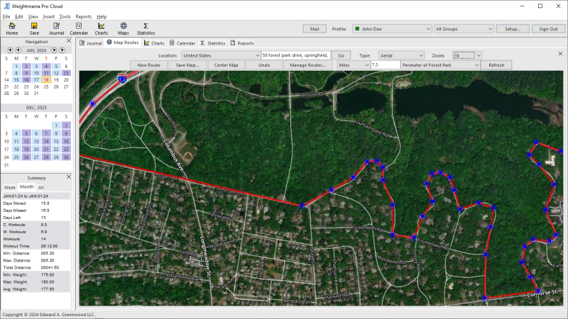
Map your running, walking, cycling and hiking routes without GPS! Draw your route and see exactly how far you went in miles or kilometers. Great for advanced planning. Map routes anywhere — on or off-road, through woods, along walkways, across backyards, and even over buildings. Eliminates the need to wear expensive, heavy devices on your arm or wrist. Choose from standard, aerial or hybrid maps. Provides 18 levels of zoom. Adjust route points with drag and drop or move the mouse over any point to see the exact Latitude Longitude. Save and share an unlimited number of routes. Our maps use the latest images and data.
Map Runs on or Off-Road
